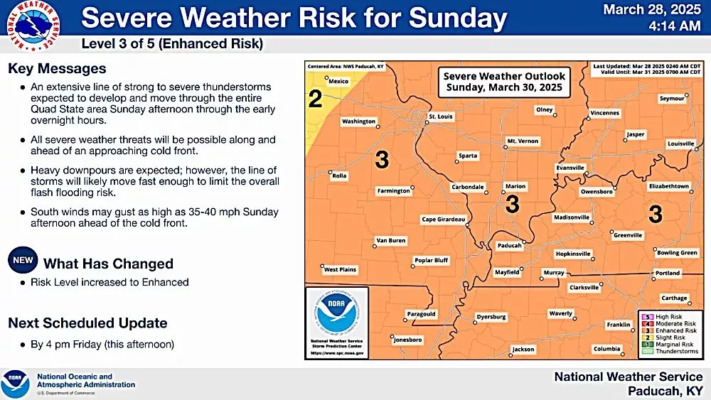
SOUTHERN ILLINOIS – The National Weather Service in Paducah says the severe weather threat level four our area has increased for Sunday with all modes of severe weather possible. We are now in an enhanced risk for severe weather.
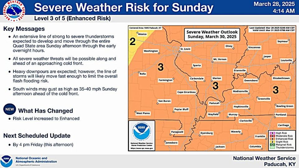
Late afternoon into the overnight hours Sunday is expected to be the main time period for severe weather. However, this may change over the next day or two.
All severe weather threats will be possible along and ahead of an approaching cold front. Heavy downpours are expected. However, the line of storms will likely move fast enough to limit the overall flash flooding risk.
South winds may gust as high as 35 to 40 mph Sunday afternoon ahead of the cold front.
Forecasters are expected to release an update later this afternoon at weather.gov/pah.