
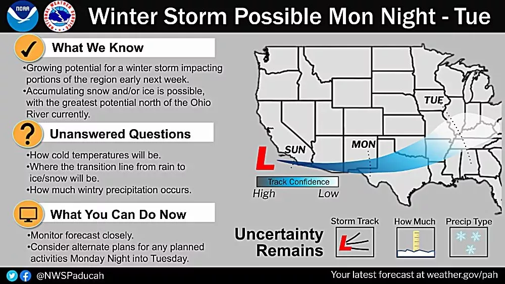
PADUCAH – A potential winter storm may impact portions of the region with accumulating snow and/or ice Monday night into Tuesday of next week according to the National Weather Service in Paducah.

Right now the areas with the highest chances to see the wintry precipitation is north of the Ohio River. However, given it’s still 4.5 to 5 days out, fluctuations are likely.
Updates will be provided as the event draws closer.